Discovering the Adventure
Big Sur Beaches North
They're Beautiful, But Big Sur Beaches North, South, and in Between Can Be Dangerous!
Before you visit Big Sur Beaches to the North - or any beach in Northern California - please follow this link to our Beach Safety Tips. You'll find suggestions for keeping you and your family safe at the beach! Use your Browser's Back Button to return here when you're finished.
Big Sur Beaches North:
Garrapata Beach
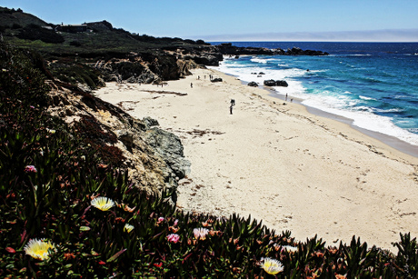
Northern-most of Big Sur's beaches, Garrapata is a pretty and partly-sheltered two-mile-long bit of sand just south of the Carmel Highlands.
It's part of Garrapata State Park, and is reached via Turnouts 18 and 19 off Highway 1.
There is no parking lot, per se. Parking is along the turnouts.
And it's easy to overlook the turnout signs, so keep a close watch for them, and be aware of the traffic around you as you slow.
The path down to the beach is easy to identify once you've done the hard work of finding the right turnout.
An Insider's Secret and A Warning: garrapata is Spanish for tick. The park, the beach, a creek, and a canyon are all named for the little critters, which should tell you something about their presence in the area. Long pants tucked into socks are especially recommended for hiking through coastal scrub.
The beach consists of white sand, rock and gravel, granite outcrops and arches, caves (some of which may have been used by the native populations hundreds of years ago), creeks, and hiking trails.
You can hike along the coast, or you can head inland from Garrapata Beach along trails that range from coastal vegetation to redwood forest.
Four Things About Garrapata Beach:
- There are no facilities here: no restrooms, no water, no food, no stores - so come prepared when you come
- It's a day use only beach
- The waters are VERY dangerous here - no wading, swimming, or climbing on rocks allowed
- Garrapata is one of the unofficial Nude Beaches I mentioned earlier. Not the whole beach actually - mostly at the north end and the south end where it's more sheltered from the wind
Things To Do At Garrapata Beach:
- Beachcombing, especially after a storm
- Strolling along the sand, building sand castles, sunbathing, picnicking
- Exploring tide pools
- Looking for sea otters, migrating Gray Whales, sea lions, harbor seals, humpback whales and blue whales; look up and inland - you might see a Bald Eagle or a California Condor soaring on the up-drafts
- Hiking the Coastal Trail, or heading on inland
- Rockfishing for greenlings and surfperch (California Fishing License required)
Big Sur Beaches North:
Andrew Molera State Beach
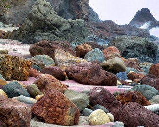
 Colorful rocks at Andrew Molera SB
CC Colette Simonds
It's a little more of a hike to get to Andrew Molera State Beach - the path is about a mile long.
The good news is, the path is relatively flat, and is quite beautiful in the spring with the wildflowers blooming.
It also gives you spectacular views of the Coastal Mountain Range.
But do be careful of the poison oak alongside the trail!
And, once you arrive at the beach - which includes the mouth of the Big Sur River - you're fairly protected from the wind by a bluff to the north. Here you'll find garnet-infused sand - you'll know it from its pinkish color - and colorful rocks, along with this:
An Insider's Secret: Andrew Molera State Beach is a gathering spot for driftwood - that's a lot of its charm because people who visit this beach like to build structures from the driftwood.
It's really a treat to walk south from the main beach and come upon tee-pees, forts, and other mysterious structures! You have to wonder, Who built this and where were they from?
Of course, you can build your own - a little imagination and you've got a beach hut, a castle, or maybe even a geodesic dome for a shelter!
Four Things About Andrew Molera State Beach:
- There are no facilities here: no restrooms, no water, no food, no stores - so come prepared when you come
- It's a day use only beach, although there is some limited and primitive walk-in camping in the park itself
- There's a pretty little lagoon with a sandy beach where the Big Sur River enters the Pacific - it's mostly safe to swim here although there's no lifeguard
- Part of Molera State Beach (accessible only during low tide) used to be utilized for nude sunbathing, but Park Rangers have sufficiently discouraged the practice to the point where it's pretty rare to run across a nudist at this beach
Things To Do At Molera State Beach:
- Have you ever wanted to go horseback riding along the beach like you see in the movies? Well, you can do that at Molera. Molera Horseback Tours operates out of Molera State Park and offers guided rides that traverse the meadows, redwood forests and beaches, spinning yarns along the way.
- Surfing - Andrew Molera is one of the best surfing spots along the Big Sur area
- Birdwatching
- Beachcombing
- Visiting the Ventana Wildlife Society and participating in programs like: Bird Banding, Condor Tours, and Counting Monarch Butterflies
- Searching for the amazing variety of ocean mammals that live in the area - sea otters, migrating Gray Whales, sea Lions, harbor seals, humpback whales and blue whales
- Hiking trails along the coast, or heading inland along the Big Sur River
- Fishing (California Fishing License always required)
Big Sur Beaches North:
Pfeiffer Beach
It's easy to get confused, but Pfeiffer Beach is not associated with Julia Pfeiffer Burns State Park.
It's a wonderful beach and one of the most popular with locals, but it's not easy to find if you don't know about it before you go.
It's about a quarter of a mile south of the Big Sur Ranger Station (about 25 miles from Carmel Highlands). Look carefully for Sycamore Canyon Road (being alert to the traffic around you) - you'll be turning west (that's towards the ocean for those of us who are directionally-challenged) onto Sycamore Canyon and following it for approximately 2 miles to get to the beach. Drive slowly - there may be children along the way.
From the area where you'll park, it's a short hike on a well-marked trail. Pfeiffer is open from 9:00 a.m. to 8:00 p.m., 7 days per week, and there's an entrance fee per auto (currently $5.00)
An Insider's Secret: Pfeiffer Beach is purple! Well, at least the sand is purple, sometimes with pink flecks. That's because there's manganese garnet in the hillside above, which has washed down onto the beach.
Also, there's a balloon tire wheelchair available to get persons with mobility problems to the beach, but someone in your party must push the chair.
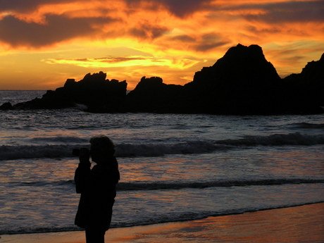
Pfeiffer's a perfect place to spend an afternoon relaxing, sunbathing, viewing wildlife, and taking in the extraordinary rock formations and sea stacks. There's one where the elements have carved an arch through the rock and you can mesmerize yourself watching the surf surge through. And the sunsets are glorious!
Four Things About Pfeiffer Beach
- There are limited facilities here: restrooms are of the non-flushing variety, there's no water, no food, no stores - so come prepared with water and food if you plan to spend some time
- It's a day use only beach. I would not recommend swimming - the current is powerful and there's no lifeguard
- This is a place for relaxing, playing in the sand, taking walks, and watching amazing sunsets - unless the wind is blowing significantly. If that's the case, it can be quite miserable with missile-like sand particles
- There may be some nudity at the far north end of the beach, beyond the rocks - also, be careful if you go to the north end; make sure you don't get stuck there by the in-coming tide
Things To Do At Pfeiffer Beach:
- Picnicking
- Sunbathing
- Reading a good book
- Scoping out the rock formations
- Watching the surfers (although I wouldn't recommend surfing to the uninitiated, there are some intrepid local surfers who seem to know what they're doing)
- Checking out the seals catching some rays on the rock islands, the migrating whales, the sea otters, and the various Sea Birds that inhabit the area or are just passing through
- Fishing (You guessed it, California Fishing license required)
- Watching the sun set in all of it's glory!
Big Sur Beaches North:
Julia Pfeiffer Burns State Park
Julia Pfeiffer Burns SP doesn't have any beach access in the traditional sense, but I'm including it here because there are a couple of relatively short hikes that lead to beautiful, interesting, and historic coastal features.
Partington Cove
This is the former anchorage for ships that arrived to load up on tan oak bark in the late 1800s.
The trailhead is just under two miles north of the main entrance to Julia Pfeiffer Burns SP (and 6 miles south of Nepenthe Restaurant).
Park alongside the road and begin your trek at the iron gate. The trail is in good shape, but it's also steep, so keep this in mind! Whatever you go down, you'll have to come back up!
You're following Partington Creek down the canyon, and if you keep to the right, you'll come to the creek's outlet and a small rocky beach with little pools and waterfalls along the way.
When you've seen enough here, back-track to the bridge, cross over the creek, then through the rock-and-wooden tunnel to emerge at Partington Cove where you'll find a few rusted relics from the tan bark days.
Explore the tide pools and the history, keep an eye out for visiting whales, sea otters, etc., or rest yourself on the convenient bench to prepare for the climb back up to the highway.
McWay Falls
Continue south on Highway 1 to the main entrance to Julia Pfeiffer Burns State Park, park in the lot, and look for the "Overlook-Waterfall Trail-Pelton Wheel" sign.
A tunnel will take you under the highway - follow the well-marked path to the right or the left.
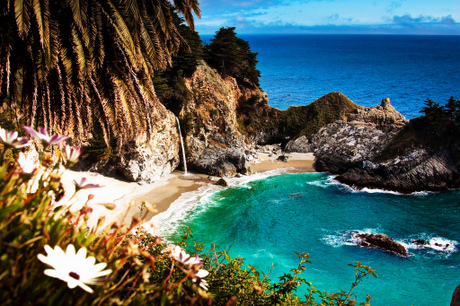
Either way you'll get spectacular views of the 80 foot waterfall dropping to the beach below, and of the coastline both north and south
Julia Pfeiffer Burns Underwater Area
Tucked between Partington Point and McWay Creek, this unspoiled underwater preserve is a very well-kept secret. Most people who visit the Big Sur area never even hear of it, partly because the ocean can be treacherous here, and permits to dive are only allotted to experienced divers.
The park extends about 2 1/2 miles, and is only accessible at the north end; there are believed to be 3 sunken ships in the park, but their positions aren't currently known.
Four Things About Julia Pfeiffer Burns SP:
- There are facilities here: restrooms, water, and public telephone, but no food, no stores - so bring your lunch when you come
- This is a camping park, but day use also - there is a vehicle fee
- The waters can be VERY dangerous here - so be always watchful in the Partington Cove area
- I've never heard of any nudity at Julia Pfeiffer - not much room for sunbathing anyway
Things To Do At Julia Pfeiffer Burns State Park:
- Wildlife viewing: sea otters, migrating whales, harbor seals, sea lions, cormorants, seagulls, pelicans, oystercatchers
- Hiking; ancient growth redwood groves; mixed evergreen and hardwood forests
- Visiting the waterfalls
- Exploring the historical structures
- Checking out the Indian village sites
- Hike-in Environmental Camping
- Picnicking
- Enjoying the fabulous ocean views (taking lots of pictures)
- Scuba diving if you're an expert
Interested in discovering more Big Sur Beaches? You know you are!
- Big Sur Beaches - Central
You'll find Mill Creek & Limekiln State Park beaches. - Big Sur Beaches - South
Head even further south for Sand Dollar, Jade Cove, & Elephant Seal Beach - they're all worth the trip! - Big Sur Nude Beaches
FYI
Please continue your exploration of what Northern California has to offer by using the Nav Bars in the left and right columns or by using the links at the bottom of the page.
Like what you're finding here at Discovering Northern California? Then please share with the Social Network of your choice.
And thanks for coming!
Related Articles
Big Sur Beaches
Beach Safety Tips
Big Sur Beaches
BS Beaches North
BS Beaches Central
BS Beaches South
BS Nude Beaches
Related Pages
Northern California Beaches
Related Articles
Big Sur
Big Sur, California
Big Sur Attractions
Big Sur Beaches
Big Sur Camping
Big Sur Day Trips
Big Sur Free Things To Do
Big Sur VRBO
Related Pages
Northern California Coast
Big Sur
Del Norte County
Humboldt County
Lake County
Mendocino County
Monterey County
Santa Cruz County
Related Pages
Free Things To Do
Free in Big Sur
Free in Chico
Free in San Francisco
Free in Sonoma
Related Pages
Things To Do
Activity Village
Attractions
Beaches
Beer Lovers Delight
Burney Falls
Camping
Casa de Fruta
Day Trips
Gold Panning
Gold Rush Sites
Healdsburg
Historic Grass Valley
Lake Shasta Caverns
Lodi
Missions
Nevada City
RV Destinations
Ski Resorts
Tide Pool Tips
Travel Tips
Weekend Trips
Whale Watching
Wine Tasting
Related Pages
Insider Secrets
Best Kept Travel Secrets
Best Winter Whitewater
Boring Road? Nope
CA Admission Day
Climbing at Castle Rock
Crabbing Spots
Dream of Dreams
Fall in Eastern Sierras
Ghost Stories
Glass Beach
Great Stays, Low Pays
How to be a Valley Girl
Jade Beach
Lake Shasta Caverns
Lassen Volcanic SP
Lost Coast
Mono Lake
Moss Landing: Whales
New Clairvaux Abbey
Panning for Gold
Pygmy Forest
Mendo to Eureka
RV Destinations
SF Great Places to Eat
SF: More About Eating
SF Neighborhoods
SF Giants Baseball
Santa Cruz: Memories
Santa Cruz: Old Friends
Sonoma Cooking Class
Sonoma History
Sonoma Top Wine Stop
Tahoe: Discovery Trail
Underground Gardens
Yosemite: Family Hikes
Yosemite: High Country
YNP: Off the Beaten Path
Yosemite: Taft Point
Ziplines


